El Niño is coming faster than expected and chances are rising that it will be historically strong
El Niño is coming faster than expected and chances are rising that it will be historically strong
El Niño is coming faster than – According to a recent update from NOAA’s Climate Prediction Center, the emergence of El Niño in the Pacific Ocean is proceeding more rapidly than anticipated. The probability of it reaching a strong or very strong intensity by fall or winter has increased significantly, with a 2 in 3 likelihood of its peak strength being marked by extreme conditions. This development signals a shift in climate dynamics that could reshape global weather patterns for the upcoming months.
The El Niño Phenomenon and Its Global Impact
El Niño represents a natural climate cycle characterized by the warming of the tropical Pacific Ocean. This warming disrupts typical wind patterns across the atmosphere, creating a chain reaction that affects weather systems worldwide. As a result, certain regions may experience heightened droughts and heatwaves, which can exacerbate wildfire risks and strain water resources. Conversely, other areas might face excessive rainfall, leading to flooding. These contrasting effects underscore the complexity of El Niño’s influence.
One of the most notable consequences of a robust El Niño is its potential to suppress the Atlantic hurricane season. By altering oceanic and atmospheric conditions, it can reduce the formation of tropical storms and hurricanes in that region. However, the central and eastern Pacific Ocean might see the opposite effect, with an intensified hurricane season. This duality highlights the varied regional responses to El Niño’s presence.
Strength Measurement and Timeline Predictions
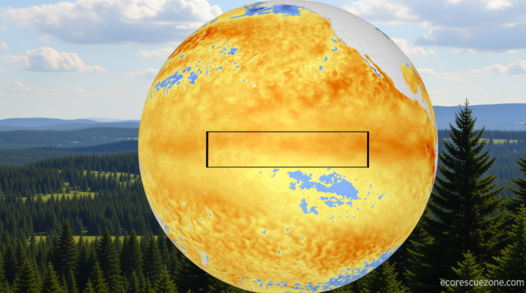
The strength of an El Niño event is determined by the degree to which sea surface temperatures surpass their average levels in the equatorial Pacific. A very strong El Niño is defined by temperatures exceeding 2 degrees Celsius above the norm, while weaker conditions are established when the threshold of 0.5 degrees is crossed for an extended period. Current observations indicate that the average water temperature is near the 0.5-degree mark, but projections suggest it will surpass this level by the following month.
This upward trend marks a departure from last month’s forecast, which anticipated neutral conditions through June. The revised outlook now points toward a likely strengthening of El Niño throughout the summer and fall. Additionally, the probability of the phenomenon persisting into winter has risen to 96%, making it a near-certainty. The confidence in this prediction stems from the accumulation of warm water in the central and eastern equatorial Pacific, which is expected to surface and amplify El Niño’s intensity.
“There is still substantial uncertainty in the peak strength of El Niño,” stated Michelle L’Heureux, a scientist leading El Niño and La Niña forecasting at the Climate Prediction Center. “However, if atmospheric changes continue to align with the tropical Pacific’s warming trends this summer, the potential for a stronger event becomes more pronounced.”
Specifically, the latest data indicates that equatorial winds are weakening in tandem with rising ocean temperatures, a scenario that could further fuel El Niño. Some of the most reliable climate models suggest that this year’s event could surpass historical records for strength. If realized, it would mark the first Super El Niño since 2015-2016, which was documented as the strongest in NOAA’s records since 1950. Previous notable events include 1997-1998, 1982-1983, and 1972-1973.
Even if this El Niño does not achieve full “super” status, it is expected to have a pronounced impact on global weather conditions. Stronger events typically exert a greater influence on climate systems, though outcomes are not always predictable. For instance, the 2015-2016 Super El Niño delivered severe droughts to the Caribbean, but it also failed to produce the typical wetter winters in Southern California. This variability emphasizes the need for ongoing monitoring and adaptation strategies.
Potential Impacts on Regional Climates
The coming months may witness dramatic changes in weather patterns across different regions. In the Caribbean and tropical Atlantic, where El Niño often curtails storm activity, the current event could lead to a quieter hurricane season. Conversely, the central and eastern Pacific might see an uptick in tropical threats, potentially increasing the risk of storms affecting Hawaii and the southern United States.
On a broader scale, the warming effects of El Niño could contribute to record-breaking global temperatures. The phenomenon is expected to intensify the already rising temperatures driven by human-caused climate change. NOAA’s recent assessment suggests that 2026 or 2027 could surpass previous records for warmth, even before fully accounting for El Niño’s influence. This underscores the role of natural climate cycles in amplifying the effects of long-term global warming.
As the event progresses, its effects will become increasingly evident. Farmers, water managers, and emergency responders may need to prepare for extreme weather scenarios. The unpredictability of El Niño’s peak strength means that while some outcomes are likely, others remain contingent on evolving conditions. For example, the presence of a Super El Niño could lead to prolonged droughts in certain areas, while simultaneously increasing the likelihood of heavy rainfall in others.
Historical Context and Future Outlook
El Niño events typically occur every two to seven years and last for approximately nine to twelve months. However, the potential for a Super El Niño introduces a new dimension to these cycles. The 2015-2016 event, for instance, not only marked a significant departure from the norm but also demonstrated the far-reaching consequences of such a powerful phenomenon.
While the exact strength of the current El Niño remains uncertain, the trajectory suggests it could rival past super events. The Climate Prediction Center’s latest analysis highlights that the warming pool in the Pacific has expanded, providing a foundation for sustained intensification. This could result in a scenario where the event’s effects are felt more acutely than in previous years.
As the world grapples with the impacts of climate change, the arrival of a Super El Niño could serve as a reminder of the interconnectedness of natural and human-driven factors. While the immediate effects are concerning, the phenomenon also offers opportunities for study and prediction. The updated forecasts from NOAA underscore the importance of staying informed about these dynamic climate patterns and their potential implications for the coming seasons.
